Glacial Geomorphology of the Aladağlar, Taurus Mountains

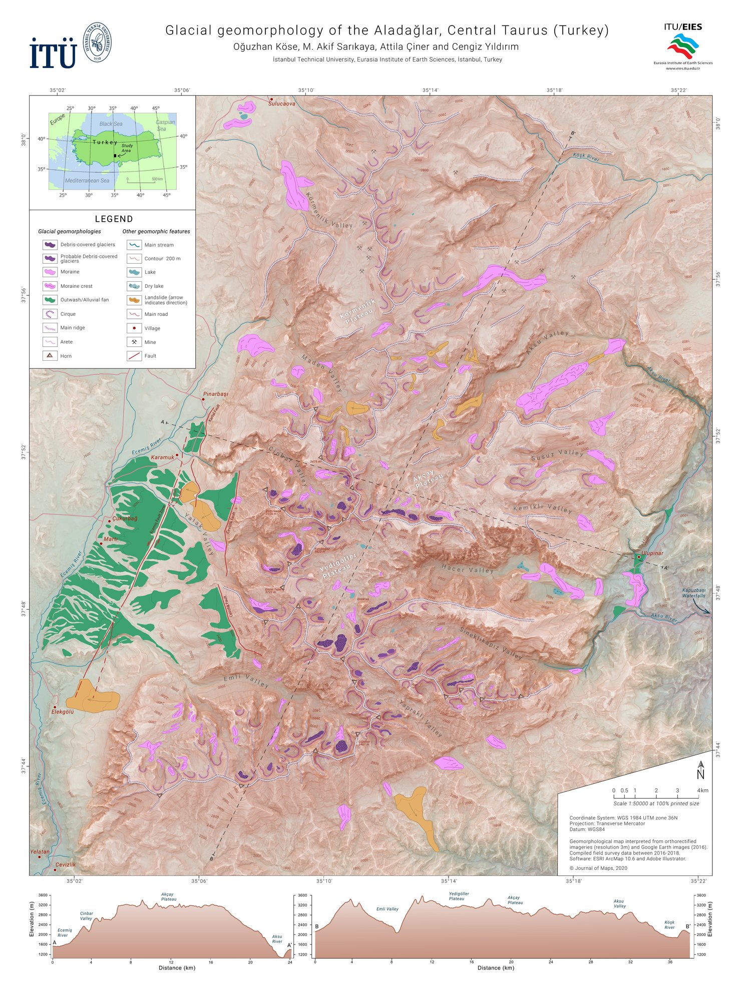
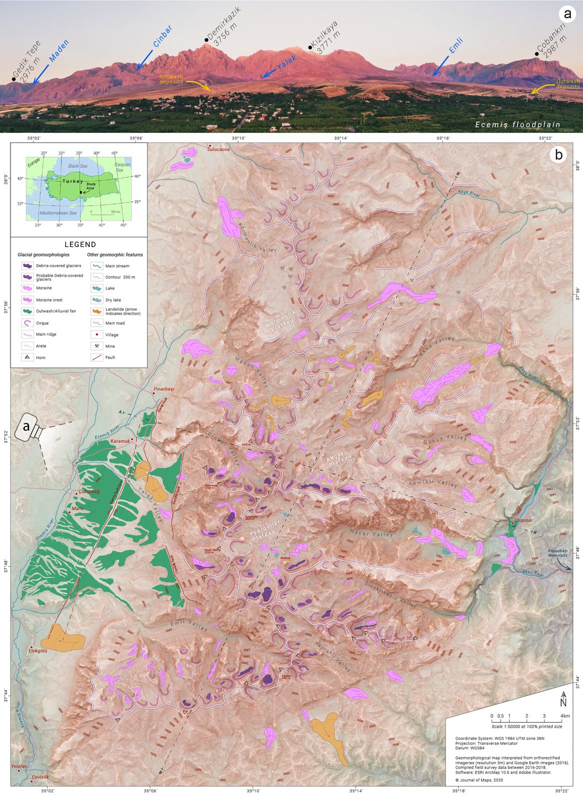
A 1:50,000 glacial geomorphological map of the Aladağlar, known as the Alps of Turkey, covering about 1,200 km². It shows cirques, arêtes, horns, moraines, debris-covered glaciers and outwash fans, mapped from remote sensing and field surveys between 2016 and 2018.

My first map to make it into a peer-reviewed journal. Three summers of fieldwork in these mountains went into it.

Field mapping, orthophotos and elevation data · UTM zone 36N · 2021 · Journal of Maps
View the paper (open access)
Glacial Geomorphology of the Aladağlar, Taurus Mountains
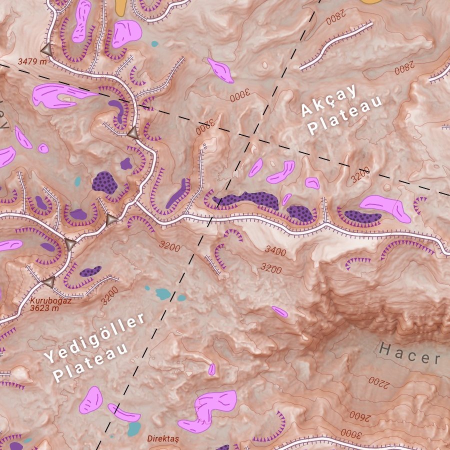
Glacial Geomorphology of the Aladağlar, Taurus Mountains, detail 1
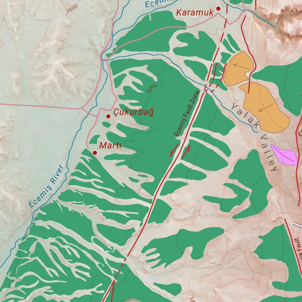
Glacial Geomorphology of the Aladağlar, Taurus Mountains, detail 2
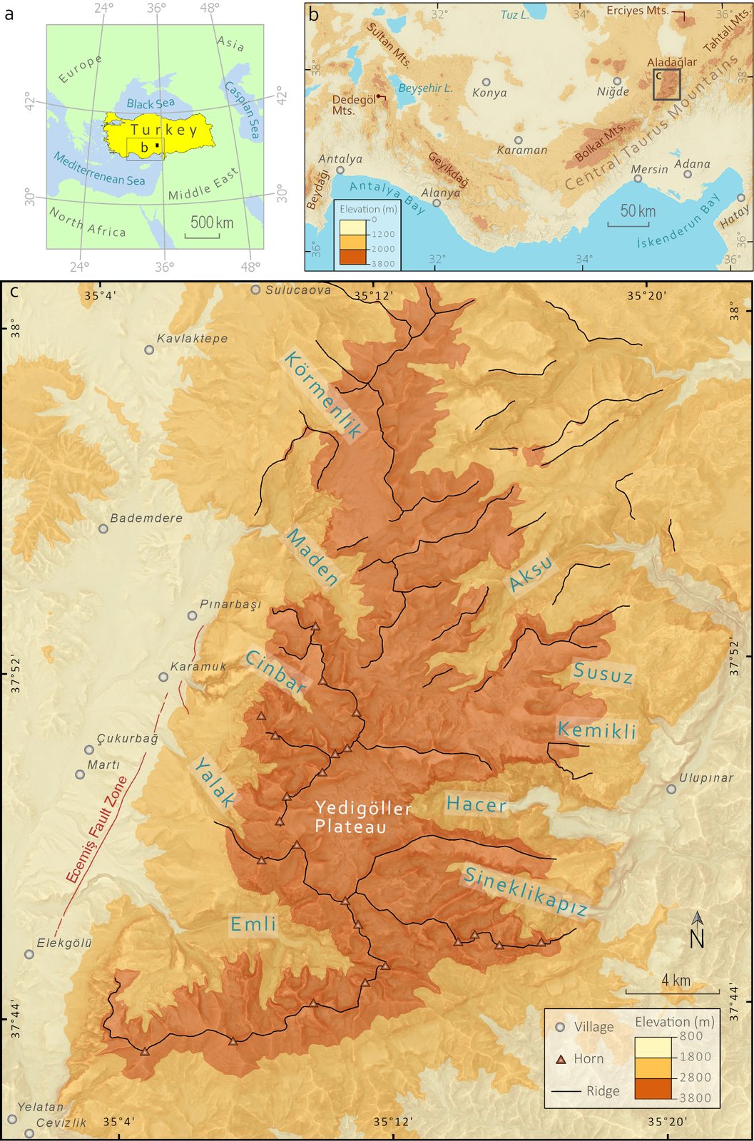
Study area
Fig. 1 · Study area
Panoramic view of the glacial valleys
Fig. 2 · Panoramic view of the glacial valleys
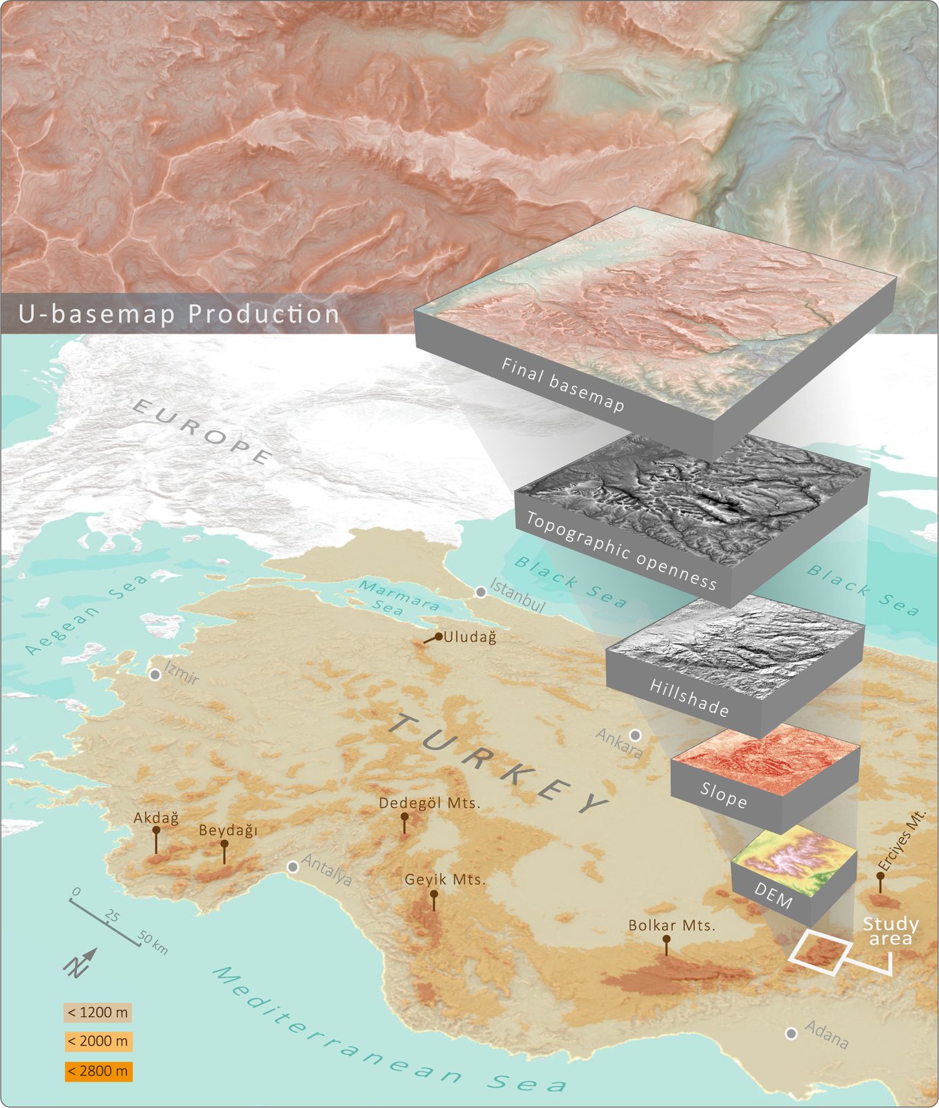
Building the relief base map, layer by layer
Fig. 3 · Building the relief base map, layer by layer
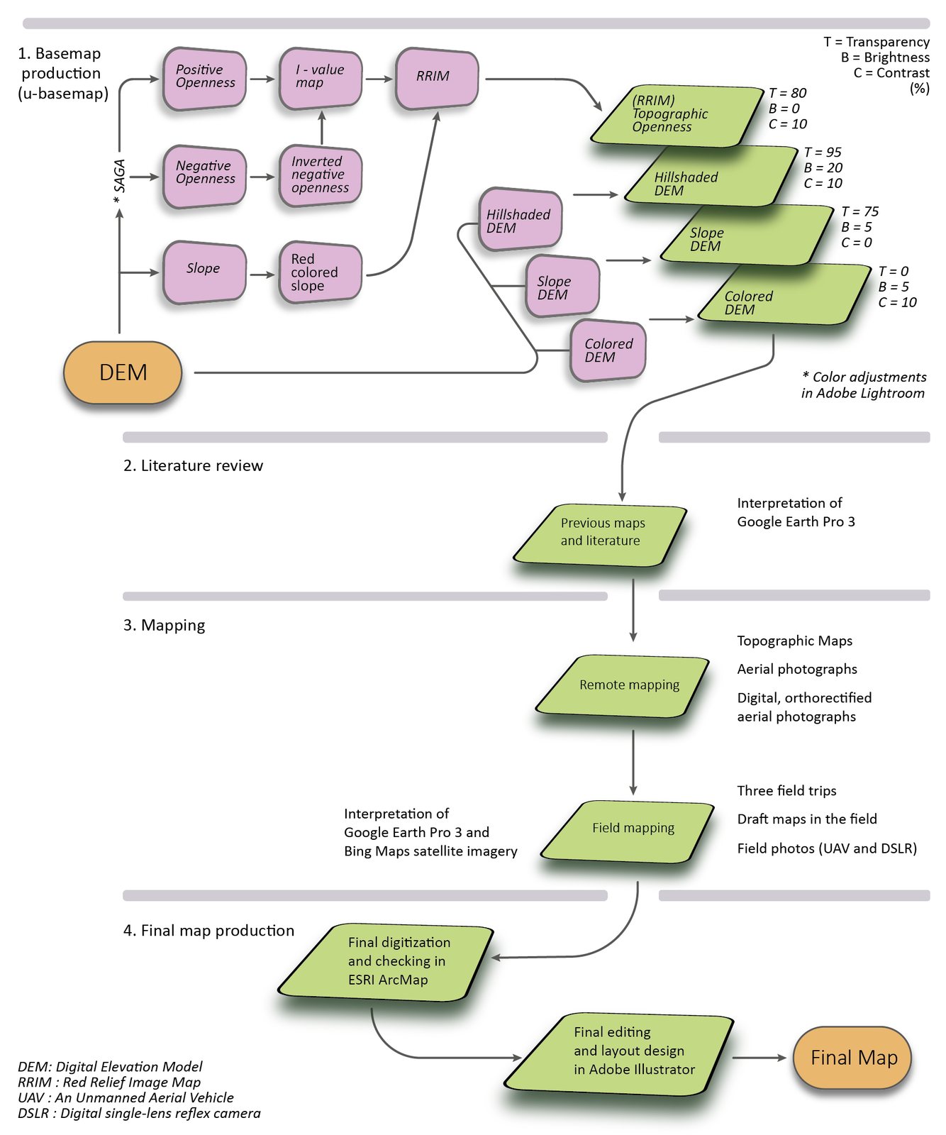
From elevation data to final map: the method
Fig. 4 · From elevation data to final map: the method
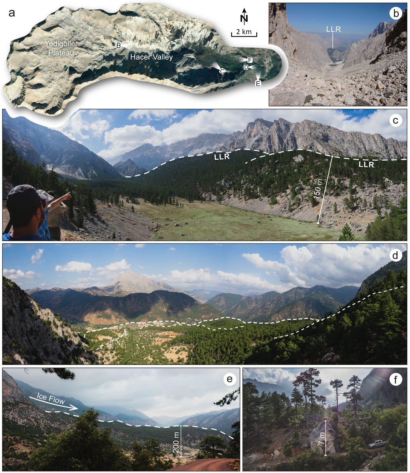
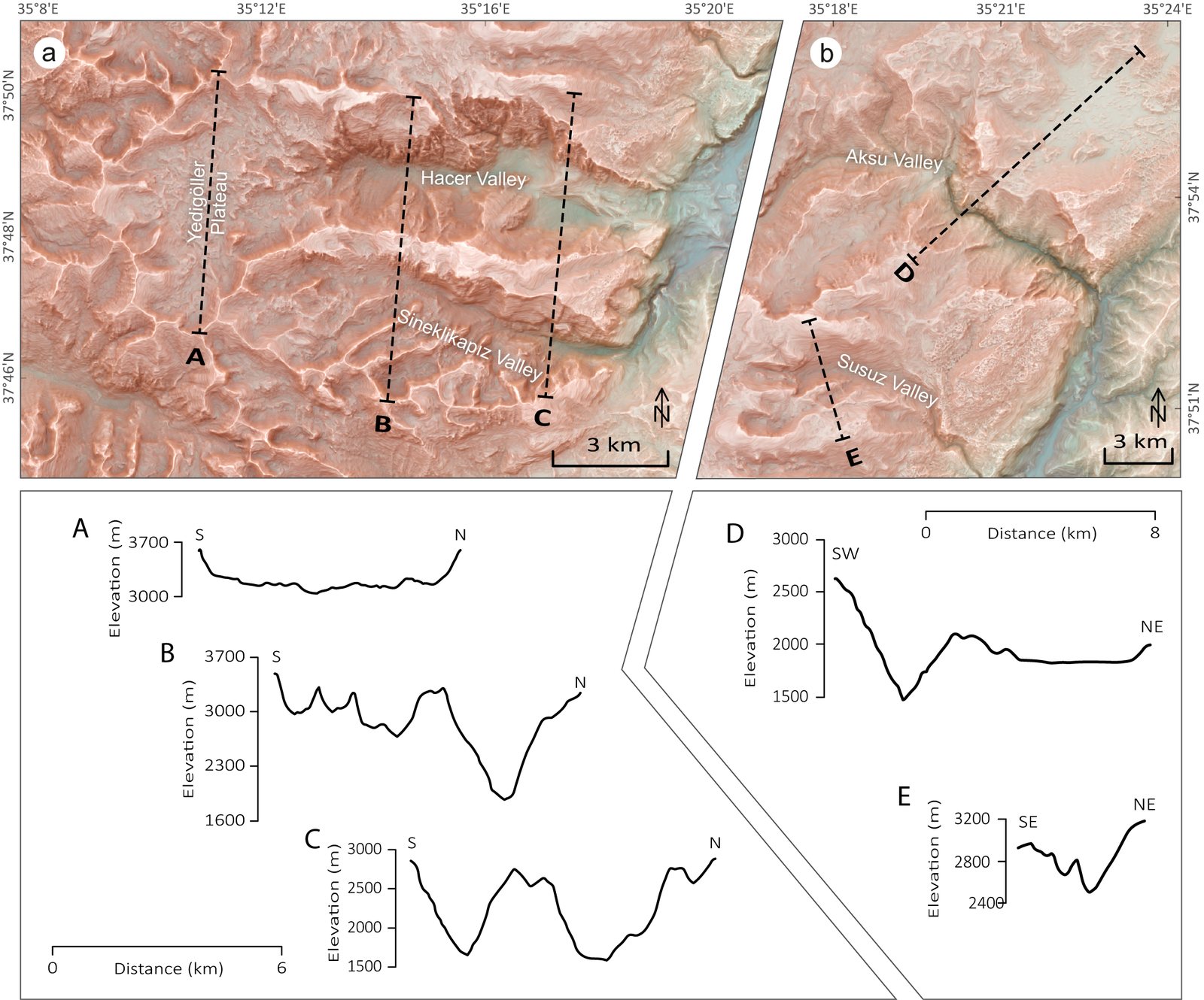
Yedigöller Plateau and the Hacer glacial valley
Fig. 5 · Yedigöller Plateau and the Hacer glacial valley
Cross-section profiles across the glacial valleys
Fig. 6 · Cross-section profiles across the glacial valleys
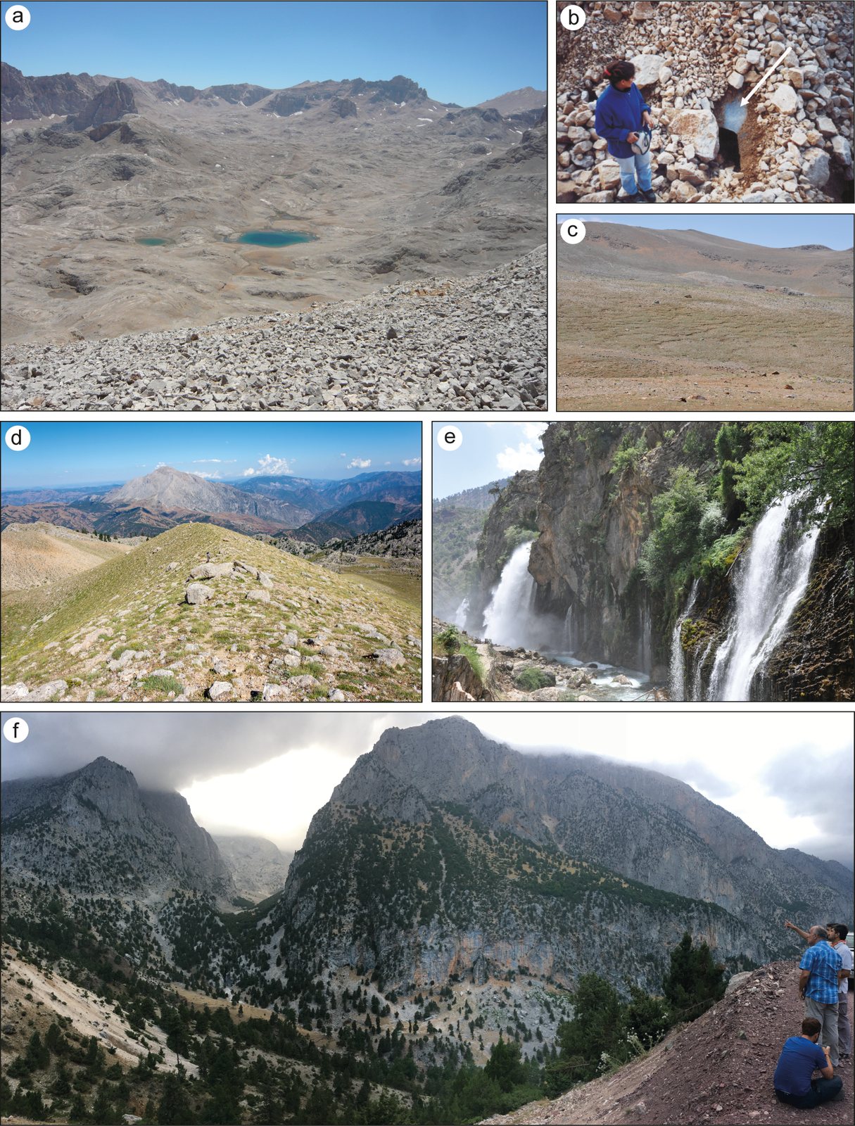
Field photos, eastern Aladağlar
Fig. 7 · Field photos, eastern Aladağlar
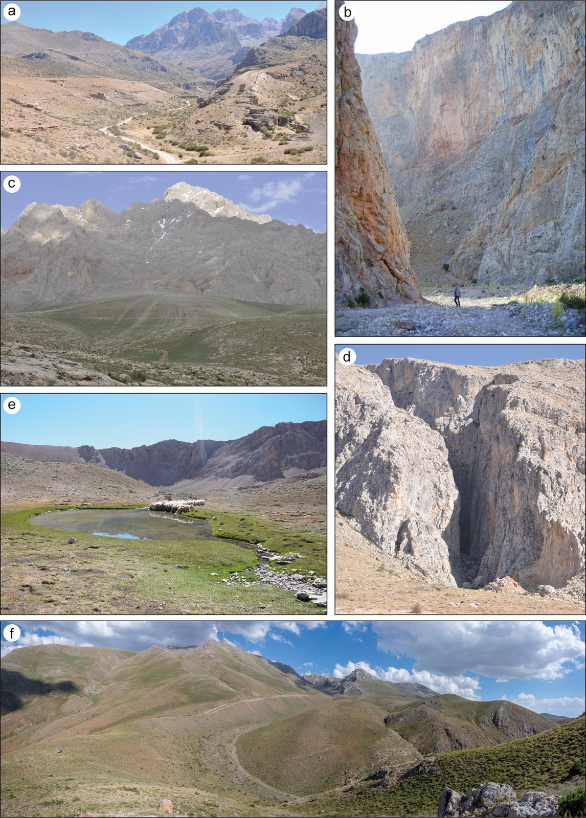
Field photos, western Aladağlar
Fig. 8 · Field photos, western Aladağlar